At the entrance into RiverView Estate are the beginning of our marked hiking trails.

The Ledges
Known officially as “Bouchoux Trail” or “Jensen’s Ledges,” The Ledges, as the locals call it, is a short but strenuous hike leading to amazing panoramic views of the Upper Delaware River Valley, along with a huge, carefully-constructed conical cairn and other stone “furniture” you can recline on as you rest from your trek and soak up the phenomenal scene.
The out-and-back trail is only about two miles long, but it is VERY steep and VERY rocky. It follows the path of a former bluestone quarry, of which you’ll see evidence all along the way.
To get to the trail, travel to Bouchoux Road in Lordville, NY. Follow Bouchoux Road about 2.8 miles to the end. The trail head is on the right side at the end of the cul-de-sac.
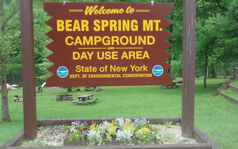
Bear Spring Mountain
Bear Spring Mountain is a multi-use facility managed by the New York State Department of Environmental Conservation. It features miles of trails along two ridges that are used for hiking, hunting, mountain biking, and horseback riding. The facility also offers rowboat, canoe, kayak, and paddle boat rentals, fishing at their stocked brown trout pond, and a beach with swimming.
From Route 17 take Exit 90/East Branch on Route 30 north to Shinhopple. Turn left on East Trout Brook Road, proceed 4-5 miles, campground is on right. You can find detailed trail descriptions for Bear Spring Mountain here.
To fish on the reservoirs you will need a regular fishing license and a DEP Access Permit, you can apply on-line.
Please look at the DEP brochure for information regarding the DEP regulations.

Finger Lakes Trail
The Finger Lakes Trail winds its way through our area over a large portion of the Cannonsville Reservoir, northwest into Barbour Brook, Steam Mill, and Arctic China State Forest, and northeast into Bear Spring Mountain Wildlife Management Area. There are plenty of parking spots all along the way, and you can choose to do a short, scenic hike along the reservoir or a longer trek through the wild forests. Here’s an interactive map to get you going in the right direction.
Rock Rift Rail Trail and Fire Tower
The Rock Rift trails are the newest addition to the greater Finger Lakes Trail System. The rail trail, approximately 7.8 miles in length, is relatively flat and makes for a fairly leisurely journey through the woods. The fire tower trail is something different altogether. It is probably not advisable for novice hikers, and hiking poles are recommended. It should be noted that the fire tower itself is unrestored and closed to the public. Overall roundtrip is approximately 5-7 miles, depending on which trail entrance you choose. More information on the trail can be found here, there is an interesting brochure on the history of the area here, and a convenient map with detailed trail description here courtesy of the Catskill Mountain Club and Finger Lakes Trail Conference.

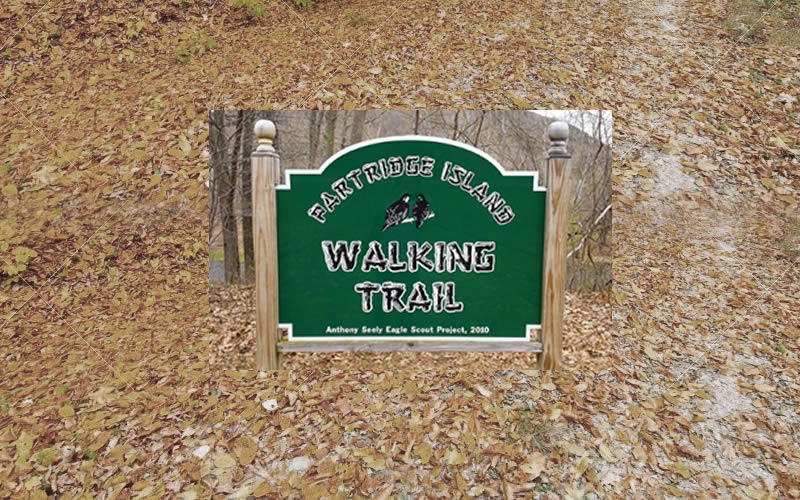
Partridge Island
Consisting of an accessible 1.5 mile trail along the Delaware River is Partridge Island. This trail offers a fully handicapped-accessible, well-groomed walk with views of the Delaware River.
Directions to this trail head, take Fishs Eddy Exit 89 or Hancock/Cadosia Exit 87a off of Route 17/Interstate 86 and follow Old Route 17 along the river until you see the large green Partridge Island Walking Trail sign.